
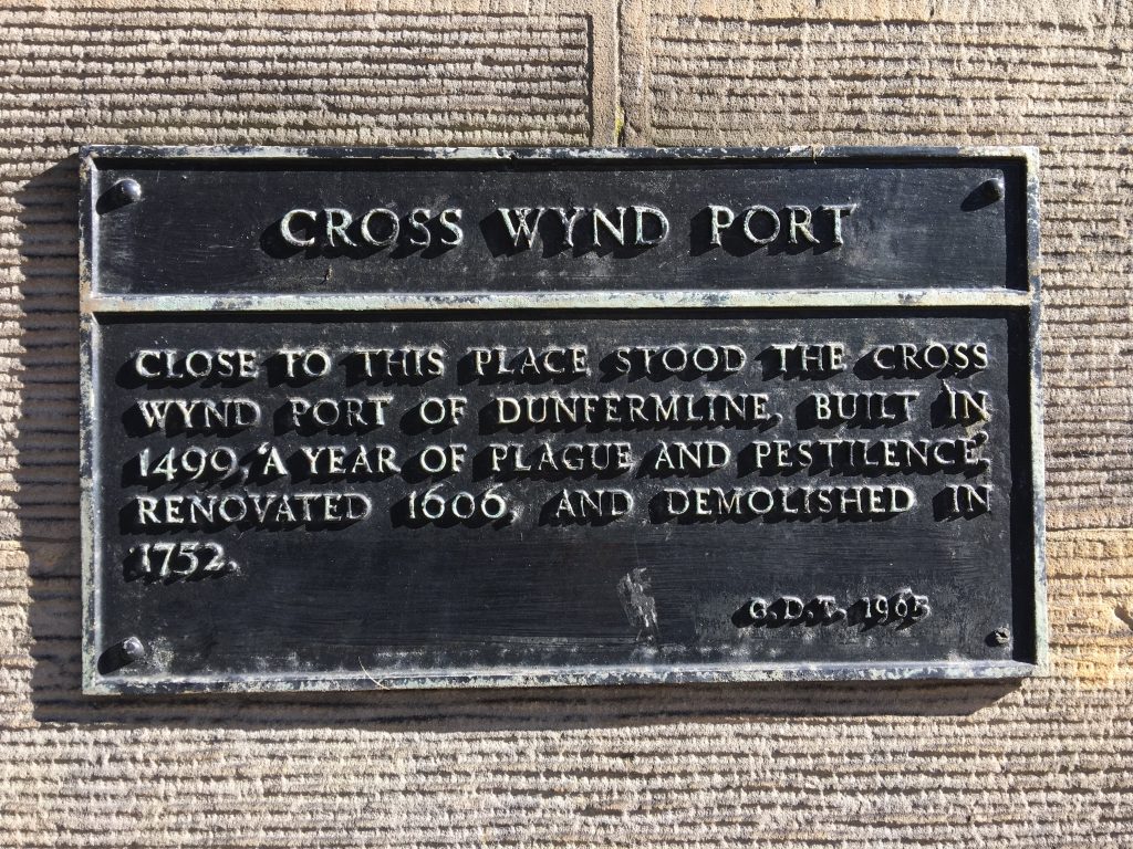
As with any medieval town, the benefits of living close to an Abbey or Palace brought elements of safety and resources but also expense. Dunfermline had entry gates or ‘ports’ to the town where payment, or tolls, were due on entering.
You’re here at Cross Wynd Port, which was a north entrance. The Ordnance Survey Map of 1832 below shows us where the East, West and South Ports were. As a Royal Burgh, it would be lucrative for traders to settle here, and other townsfolk would benefit from being part of a bustling community, safe high up on a hill, with the amazing views you can still enjoy today.
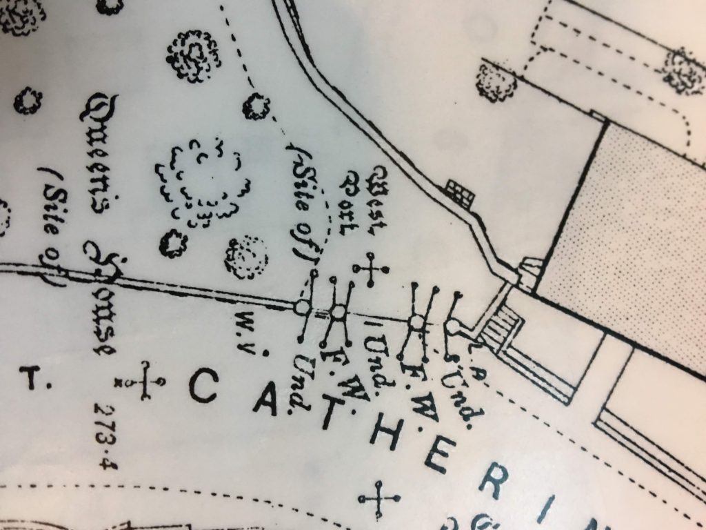
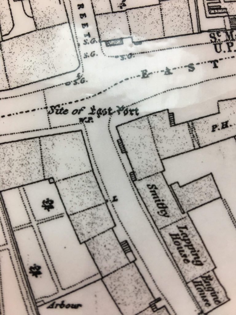
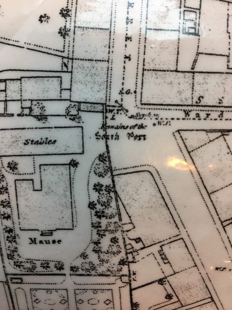
Courtesy Ordnance Survey, 1832
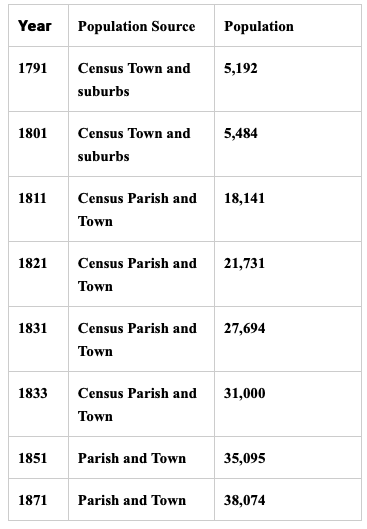
You can find out more about life in the Royal Burgh in “Reminiscences of Dunfermline”, by Alexander Stewart, which was published in 1886. It contains stories, characters and the history of the town as recalled by Stewart, an inhabitant of the town his entire life. He includes the census details of Dunfermline, featured below:
Weblinks: