On the Street today you can get a beer, have your teeth whitened, buy flowers, enjoy a manicure, file taxes, frame artwork, get a haircut, a tattoo or arrange a funeral. A whole range of facilities and experiences are on offer.
As one of the city’s oldest streets it has always offered opportunities for trade, accommodation and leisure.
The 1800s brought factories to the industrious town and there are three fantastic maps we can use to help tell the story from 1823, 1854 and 1893.
Reproduced with the permission of the National Library of Scotland
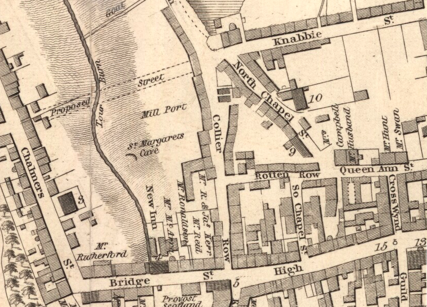
A map by John Wood in 1823 shows the old name of Collier Row, and his survey was complimentary
“…one of the most considerable manufacturing towns in the county. The manufacture of damask and diaper table-linen, has here been carried to the utmost state of perfection…”.
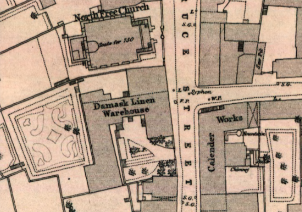
Collier Row became Bruce Street in 1833 and we see the next Town Map of 1854 shows this. There’s also more information on the businesses, their trades and shape of the buildings.
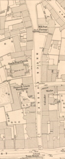
We witness the growth of the town reflected in the buildings on Bruce Street. The North Free Church you are standing beside was built in 1850 with capacity for 750 people (look closely). Mill Port Factory tops the street employing 50 workers (43 girls and 7 men), including girls as young as 13 whose nimble fingers were needed for the detailed threading work. The Calender Works and Damask Linen Warehouse dominate the street as the weaving industry grows.
At the start of the century the west (left) side of the street was a wilderness with a steep hill leading down to St Margaret’s Cave. By 1854 there are larger buildings on the west side and even a formal garden behind the Warehouse.