You are standing on the corner of Bruce Street and Queen Anne Street. This was once called Rattan or Rotten Row and used to be much longer, running parallel to the High Street, or Causgait as it was known then (because of the causeys we now call cobbles).
One date from school history lessons most of us remember is 1666. What do you associate with that year? Samuel Pepys writing in his diary? Isaac Newton’s discovery of calculus? Or the Great Fire of London, which lasted five days and burned a third of the city?
Dunfermline had its own Great Fire on 25th May 1624, which destroyed a huge part of the ‘Over-town’, and it started somewhere near here!
In the 1600s Scotland did not have a standing army but had a volunteer fighting force which had kept Scotland safe for centuries. The Drill Hall at the top of this street is a more recent example of where volunteers would learn drills and techniques to defend the country. It was used by volunteer forces up until the 1960s.
Back in 1624 the town council ordered a wappinshaw – a literal ‘weapon-show’ with a gathering of men to train them to defend the nation. Swords, halberds and blades would be sharpened and any muskets would be checked and their ammunition counted.
William Anderson was 20 years old, a son of (councillor) Bailie Anderson and later a Bailie himself. He was at home on Bruce Street with his musket, possibly showing his friends what he had learned at the wappinshaw that day. To fire a musket requires lighting the gunpowder with a smouldering flame which was kept in a metal box, known as a match. When Anderson took out his match a spark was blown onto a nearby thatched roof and the fire began.
This illustration from Extracts from the Burgh Records of Dunfermline in 16th and 17th Centuries shows the wind direction on the day of the Great Fire. A strong west to east wind was blowing and X estimates the starting point of the blaze. Rotten Row was early to burn, the buildings made mostly of rough timber. (Rattan was another word for rough, hence the name of the Row.)
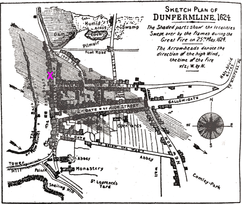
Dunfermline Burgh Records
Research suggests the often quoted figure of 90% destruction refers to the ‘Over-town’- it being the area north of the Abbey grounds. If the ‘Netherton’ is included, the estimated damage to the town would be nearer 50%. It was still a devastating fire, leaving 287 families without housing at a time when there had been terrible harvests in 1621 and a very wet 1623 had resulted in famine across Scotland. Dunfermline burial records show 400+ burials in 1623, compared to the normal number of around 40.